We’re not trying to get political, but it’s a simple truth that most borders are arbitrary. Whether established by tribal loyalties, quirks of geography, or a line scrawled on a map during the collapse of an empire, nations are defined by imaginary lines, and this can inevitably pose some imaginative problems.

Standing at the border line Getty Images/iStockphoto
These are the world’s weirdest frontiers, from a buffer zone bristling with machine guns, to an island that looks into the past…
1. Baarle-Nassau-Hertog, Netherlands-Belgium
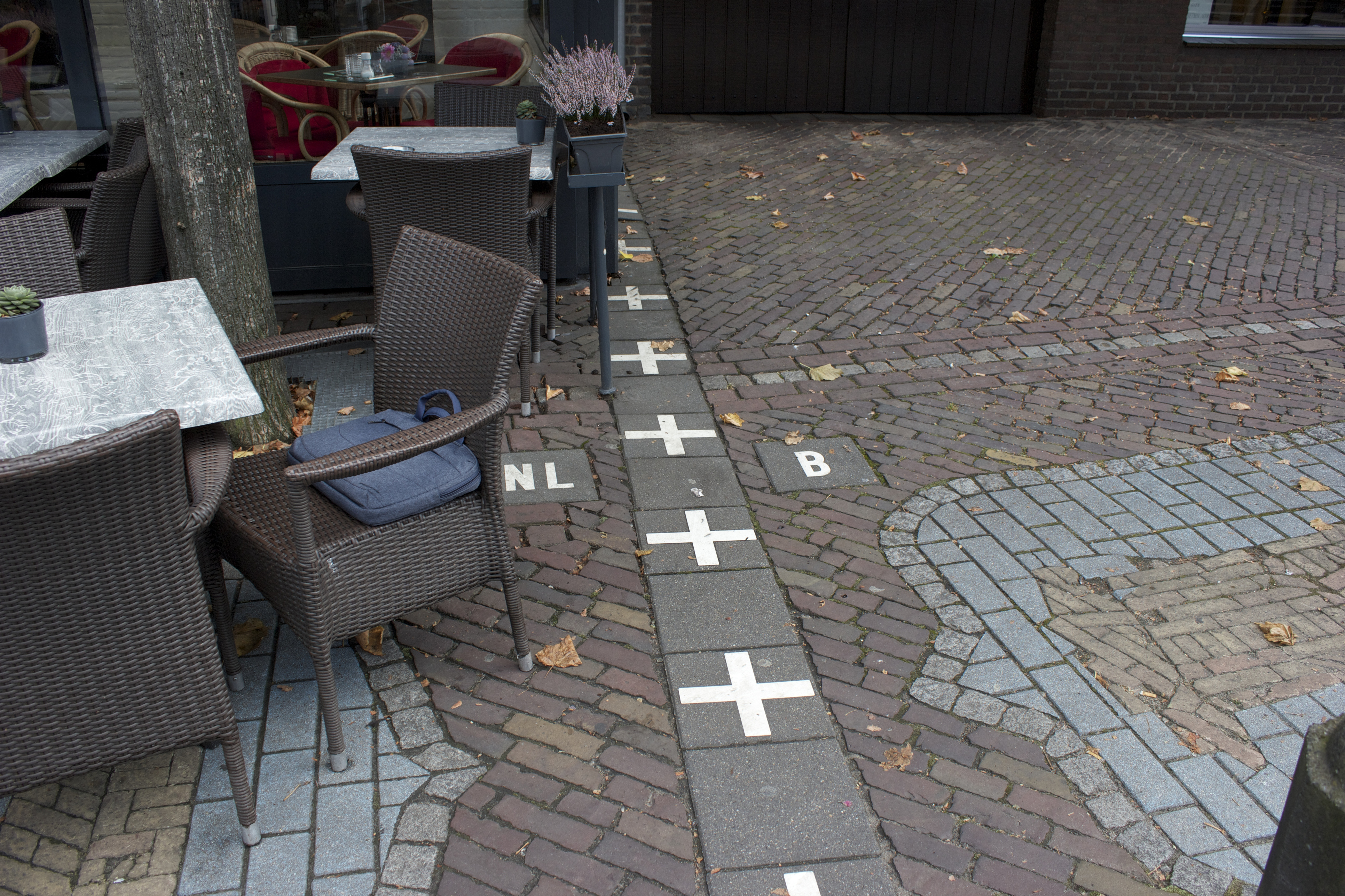
Bear with us, because this is going to take some explaining. Baarle is a village on the Dutch-Belgian border, which, due to a rent dispute between medieval lords, is split into a patchwork of tiny territories divided between the two countries. The town is filled with second order enclaves – part of one country, inside another country, which is itself surrounded by the first country – some so small they’re mapped out house by house.
There are families that sleep in different nations, supermarkets in which each aisle flies a different flag, and a ring road which switches between traffic laws. It’s just as well both countries are in the Schengen area, or residents would have to show their passports several times while queuing for the post office.
Until recently, it wasn’t even the most complex border of it’s kind. Prior to a land swap in 2015, the Indian-Bangladeshi border in the Cooch Behar region was so messy it contained a third order exclave – a piece of India within an area of Bangladesh, inside a piece of India, within Bangladesh. Phew.
2. Pheasant Island, France-Spain
A minuscule strip of soil bisecting the Bidasoa River, Pheasant Island offers geographical proof that sharing is caring. In 1659, King Louis XIV of France and King Philip IV of Spain met on the islet to sign the Treaty of the Pyrenees, bringing to an end the Franco-Spanish War.
As a symbol of this newfound friendship, uninhabited Pheasant Island became a shared condominium, and to this day it is owned by France for six months of the year, and handed over to Spain for the rest.
3. Diomede Islands, Russia-USA
Midway between Alaska and Chukotka, the Diomede Islands are divided by national allegiance, 3.8 kilometres of sea, and every single one of the world’s time zones. Administered by Russia and the United States respectively, the two territories are bisected by the international date line, so to look from one to the other is to look either into yesterday, or tomorrow.
Liable to cause brain pain if thought about for too long, the Diomede Islands serve up a befuddling reminder that everything is fundamentally arbitrary. Borders, nations, even time itself.
4. Bir Tawil, Egypt-Sudan
Historically, land is the world’s most coveted commodity. Wars have been fought and thousands killed over tiny patches of soil, and regions like Kashmir and Crimea remain contested territory.
Bir Tawil is, if such a thing is possible, the opposite – a strip of desert on the outskirts of the Sahara that absolutely nobody wants. Though wedged between Egypt and Sudan, neither nation is willing to administer the area, ironic since both claim the Halayeb Triangle next door.
Various backpackers and Twitter users have attempted to claim Bir Tawil over the years, though none has achieved international recognition.
5. Korean DMZ, South Korea-North Korea
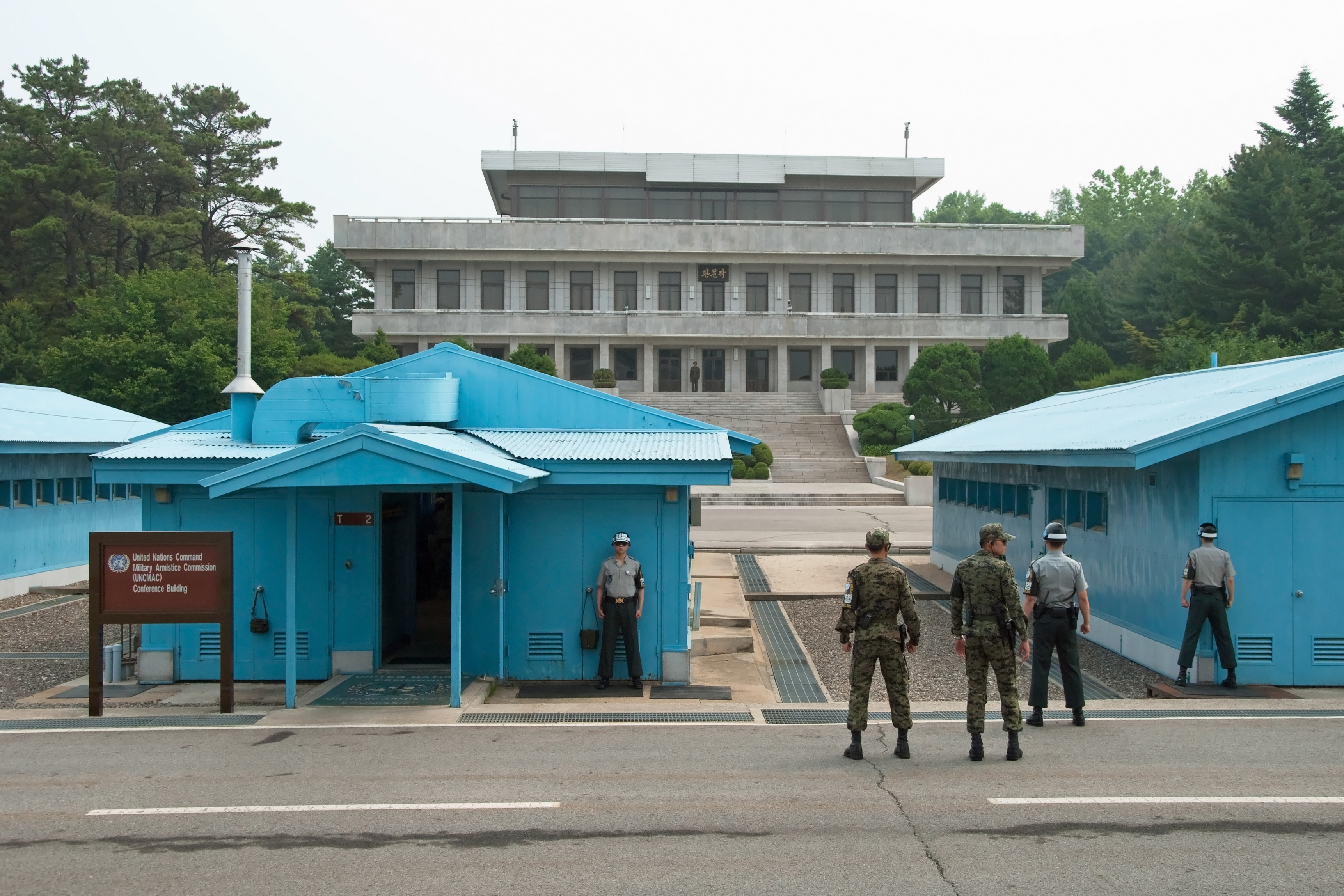
Not so much a border as a carefully negotiated, two-and-a-half-mile-wide buffer zone that may be preventing World War III, it’s no secret that this boundary is, to put it mildly, unusual.
The Joint Security Area near Panmunjom provides the only point of contact between the rival nations, and one of the huts contains a table that straddles the border so officials can hold meetings without leaving sovereign territory.
The rest of the border is flanked by barbed wire and artillery, but the area between has become a sanctuary for wildlife – a common consequence of removing man.
6. Penon de Velez de Gomera, Spain-Morocco
There is nothing overtly complicated about this obscure North African frontier – it’s just really, really small.
Dividing mainland Morocco from the tiny fortress of Peñón de Vélez de la Gomera, one of several Spanish castles that still dot the country’s coastline, the border itself was underwater until the 1930s, when a sandy isthmus formed after a storm. Today, the border clocks in at 85 metres – the shortest single land border in the world – and is marked by a rope.
Tagged in Travel


